Map with Precision: Terrestrial and UAS LiDAR to Capture Complete Site Data
Advanced airborne and terrestrial measurement services deliver accurate models that support smarter planning and design decisions.
Measure Your Site With Proven Precision
Detailed models and verified measurements support every phase in Florida and Alabama
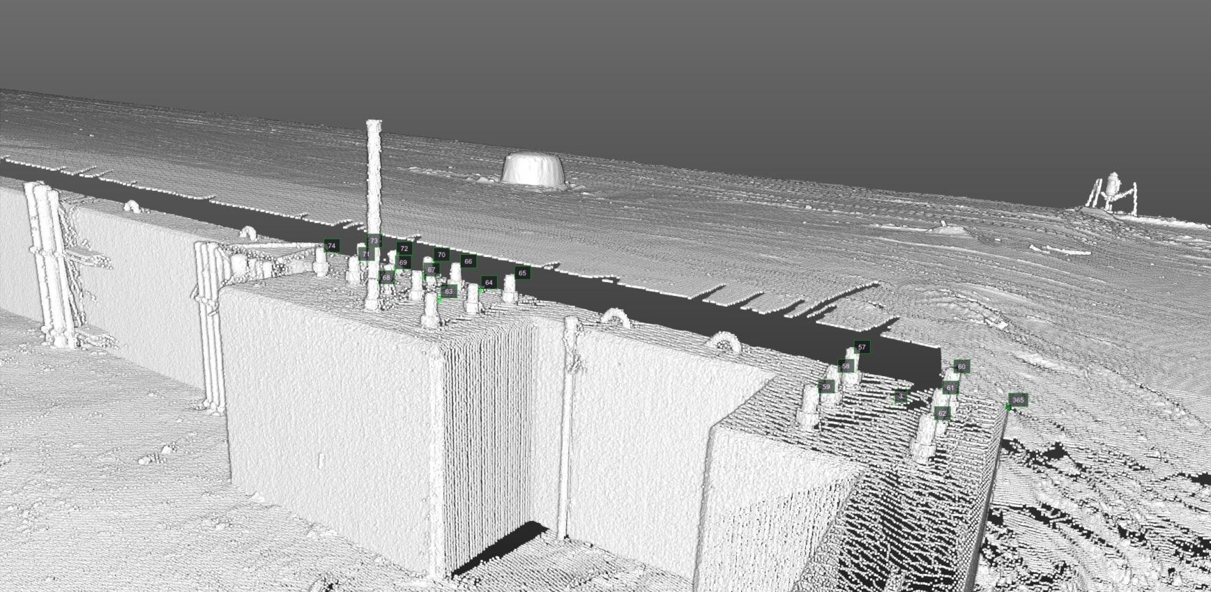
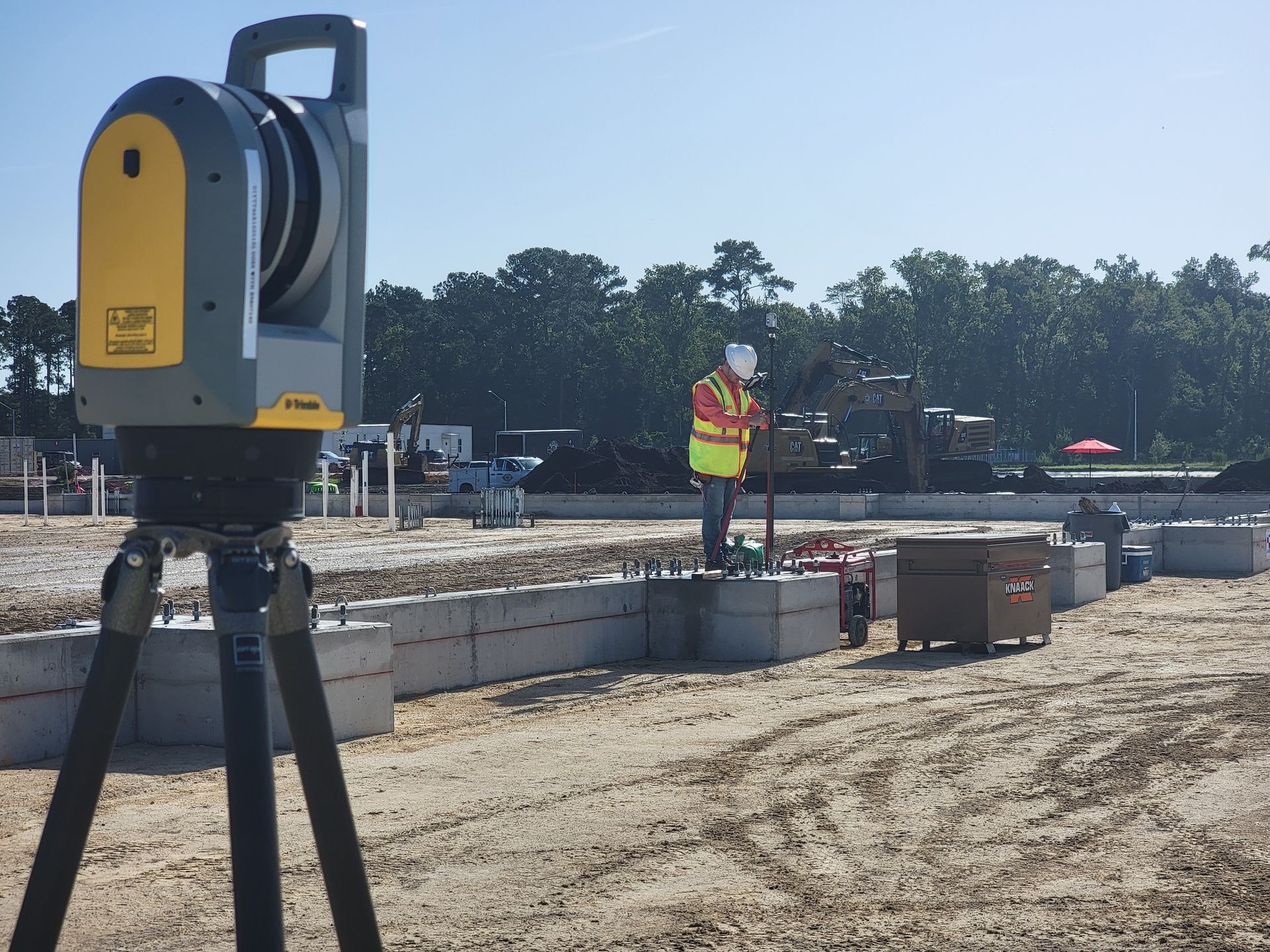
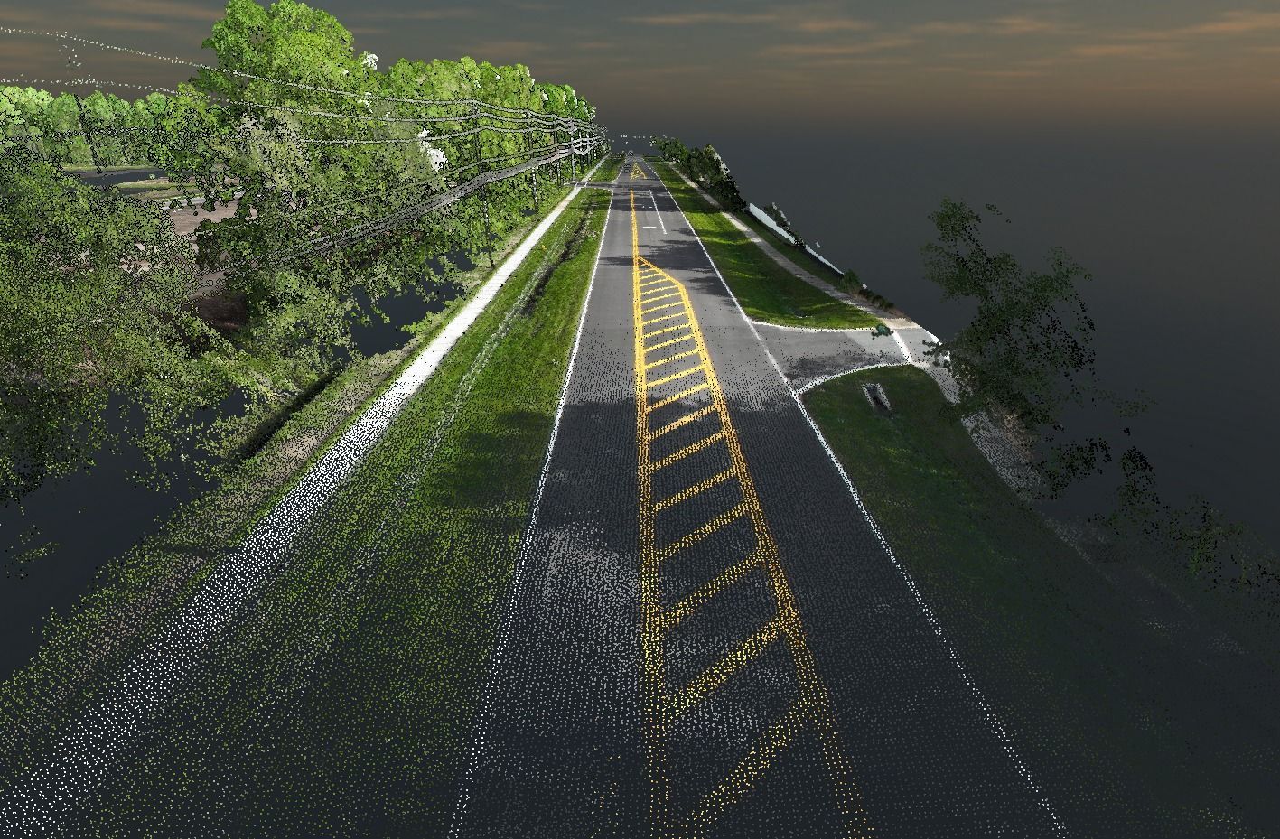
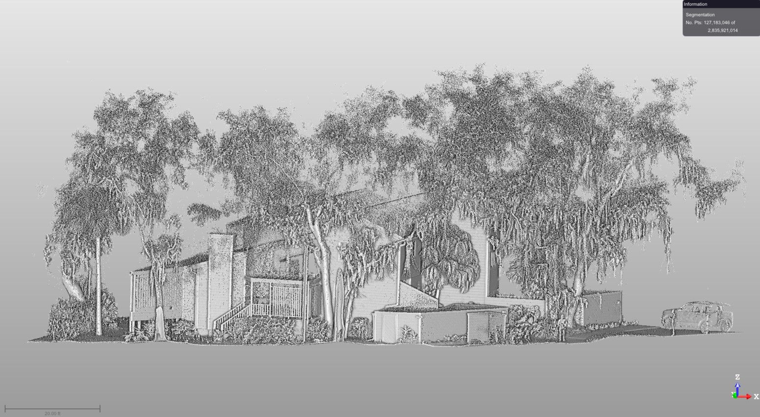
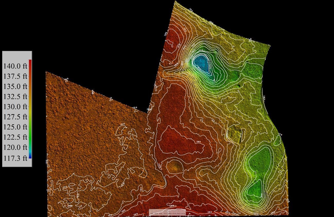
When you're planning a project in Jacksonville, Florida, the surrounding areas, or select locations throughout Alabama, understanding the true shape and condition of your site is essential before design work begins. Aerial Metrology & Inspection provides advanced reality-capture and measurement services that combine Airborne LiDAR, Terrestrial LiDAR, and Photogrammetry to deliver highly accurate site data. Contractors, developers, and homeowners rely on this information to make informed decisions from the earliest stages through final delivery.
You'll receive detailed models, reports, and verified measurements that reflect real-world conditions and support confident planning. Whether you're evaluating grading challenges, preparing material estimates, or confirming that construction aligns with approved plans, the data you work with needs to be dependable. Our approach ensures you have a clear picture of your site in Jacksonville and the surrounding areas so you can move forward without guesswork or surprises.
Aerial Metrology & Inspection helps you reduce costly overruns, improve estimating accuracy, and verify that every phase of your project meets design intent and quality standards. We also offer subcontracting options that integrate seamlessly with your team's workflow and schedule.
Contact us to discuss your project needs and discover how our measurement services benefit contractors and property owners in Jacksonville, Florida, and its surrounding areas, along with select locations in Alabama.
Our services perfectly cater to architecture, engineering, and construction firms, offering extensive survey support for diverse project requirements.
Coordinated Data Delivery and Project Expectations
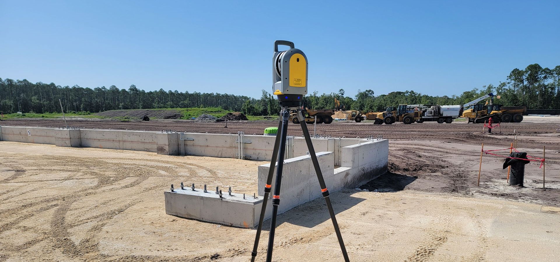
Knowing what to expect from your measurement partner makes planning easier and keeps everyone on the same page. We walk you through each stage of the data-capture process so you understand the timeline, deliverables, and how the information will be formatted for your team. From initial flight planning to final model delivery, every step is documented and shared with clarity so there's no confusion about scope or output.
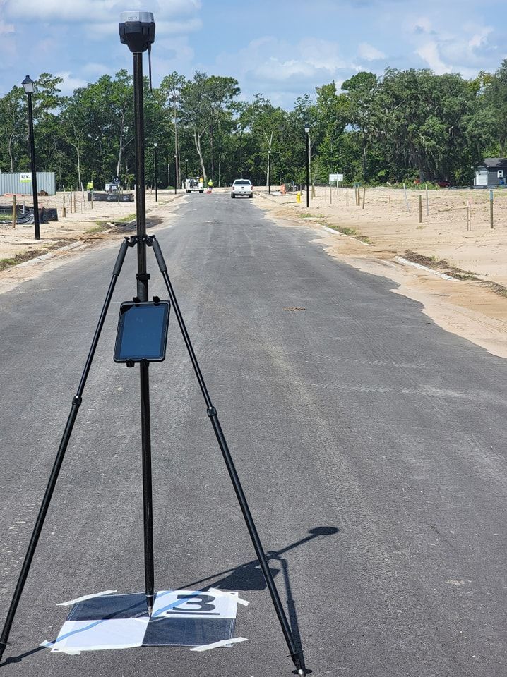
You'll know when fieldwork is scheduled, what equipment will be deployed, and how long processing will take before final files reach your inbox. This level of coordination ensures you can plan around our work and integrate the data into your design, estimating, or verification workflows without delays or miscommunication.
Our reality-capture and measurement services are built to support a range of project needs:
- Sitework and building quantity take-offs provide the detailed material and earthwork measurements that improve estimating accuracy and prevent budget overruns during construction
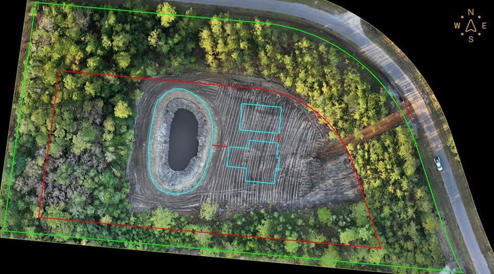
- Volumetric analysis delivers precise calculations for informed decision-making when grading, excavation, or material movement is involved
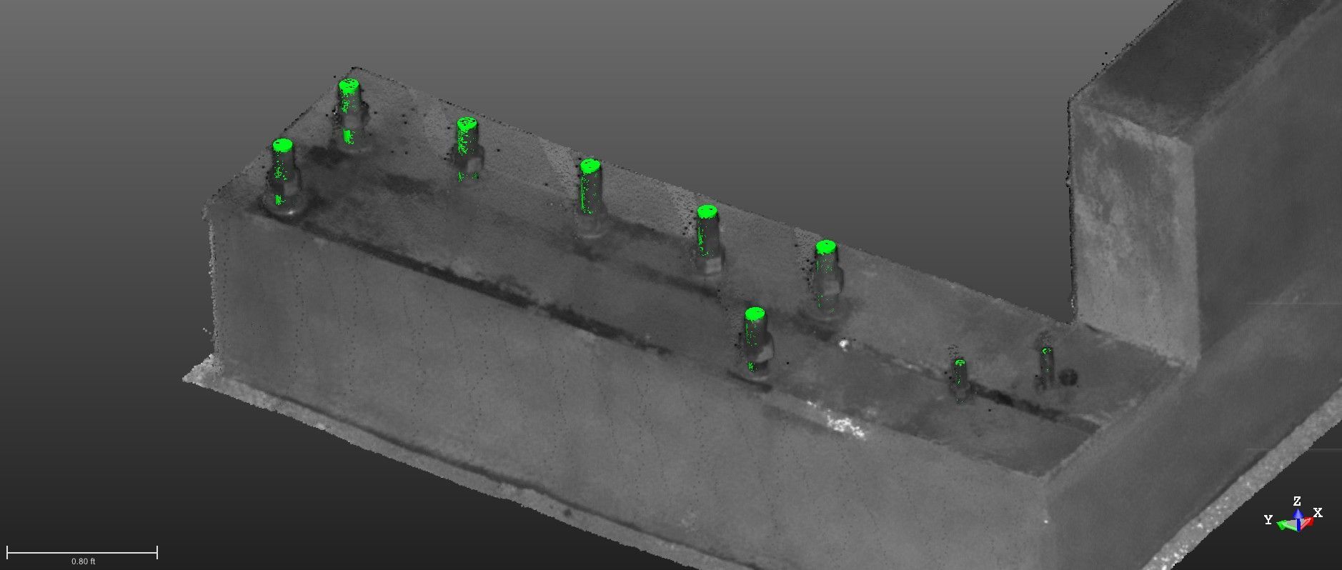
- Construction verification and as-built documentation confirm that your project is built to design and meets quality standards at every milestone
- Residential home site consulting offers homeowners and builders in Jacksonville and surrounding areas clear guidance on buildability, grading, and efficient home placement before construction begins
Contact us to schedule a consultation and learn how our coordinated approach delivers results for projects in Jacksonville, Florida, and its surrounding areas, along with locations throughout Alabama, including Clanton, Birmingham, Tuscaloosa, and Montgomery
WE ARE A FLORIDA LICENCED SURVEYING AND MAPPING FIRM - LICENSE #LB8710
Build Confidence With Verified Project Documentation!
Dependable Service Rooted in Local Knowledge
Aerial Metrology & Inspection works across a wide range of sites in Jacksonville, Florida, and throughout Northeast and Central Florida, including Yulee, Fernandina Beach, St. Augustine, Orlando, and Tampa. We also support projects across Alabama, including Clanton, Birmingham, Tuscaloosa, Huntsville, and Montgomery. Our familiarity with local terrain and regional conditions allows us to deliver reliable, accurate results.
We understand how critical verified measurements are to your project’s success, which is why we take full accountability for the data we provide. Every flight plan, scan session, and model output is reviewed to ensure it reflects true site conditions.
From initial consultation to final delivery, our team maintains a strong focus on professionalism, quality, and follow-through. We also offer flexible subcontracting options that allow us to integrate seamlessly with your existing team.
If you’d like to discuss an upcoming project or learn how our measurement and inspection services can support your goals, contact Aerial Metrology & Inspection—we’re here to help.